

Travel disruption is anticipated as Storm Ciaran brings heavy rain and wind to Wales.
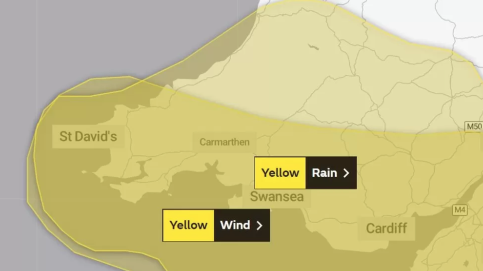
The Meteorological Office (Met Office) has issued yellow warnings for both wind and rain, raising concerns of travel disruption in various parts of Wales. These warnings are currently in effect for south and mid Wales on Wednesday and Thursday, coinciding with the impending arrival of Storm Ciaran in the UK.
In addition to these warnings, National Resources Wales has issued one flood warning, along with nine flood alerts, further heightening concerns for potential flooding in affected areas.
Forecasters have cautioned that the regions experiencing the most significant impact may witness rainfall totals ranging from 40mm (1.5 inches) to 60mm (2.3 inches).
Furthermore, Dyfed Powys Police received a report at 08:20 GMT regarding a landslide incident on the road between Trevaughan and Cynwyl Elfed, leading to a road closure in both directions. As a result, motorists are advised to divert and use the A484 as an alternative route.

The most recent rain warning encompasses a wide range of areas, including Blaenau Gwent, Bridgend, Caerphilly, Cardiff, Carmarthenshire, Ceredigion, Merthyr Tydfil, Monmouthshire, Neath Port Talbot, Newport, Pembrokeshire, Powys, Rhondda Cynon Taf, Swansea, Torfaen, and Vale of Glamorgan. This warning will be activated at 18:00 GMT on Wednesday and will remain in effect until the end of Thursday.
Additionally, there is a separate yellow wind warning in effect for Thursday until 18:00 GMT. Furthermore, a more severe amber wind warning applies to parts of Pembrokeshire on Thursday, commencing at 03:00 and concluding at 13:00 GMT.
The Met Office has cautioned that these weather conditions may result in potential damage to buildings, as well as the possibility of power outages and travel disruption.