

QUESTIONS have been raised over the concentration of new developments in areas surrounding a small strip of the M4.
Work on a planning blueprint for Monmouthshire is currently taking place, but residents in towns and villages along the motorway corridor east of Newport feel they are paying the price of the county’s growth through the loss of open space.
A 1,256 signature petition was presented to the county council in September which called for the authority to “save our green open areas” in Magor and Undy.
The petition, which also called for the council to drop plans for two potential Gypsy Traveller sites – and only the Magor plot remains under consideration – highlighted “the further loss of the limited remaining ecologically rich green areas within our village and community”.
The next step in how the council manages future development is on Thursday, October 26, when councillors will be asked to approve a preferred strategy for its replacement local development plan, that sets out where new housing and employment sites should be developed through to 2033.

When the proposed strategy was considered – and rejected – by a cross-party scrutiny committee in September, independent councillor for Magor West Frances Taylor said comments from the council’s planning officers that only a small percentage of land is identified for development disregarded the concentration on Severnside.

The area, which roughly equates as Caldicot and surrounding villages along a six-mile stretch of the M4 from Magor to the Second Severn Crossing, is identified as suitable for new developments as it is considered “sustainable” due to transport links.
But Cllr Taylor told officers responsible for the plan: “You said only three per cent of the county is actually developed, but not in Magor and Undy, not in Severnside generally. It’s slightly misleading to refer to the whole of Monmouthshire.”
The latest amendments to the plan have reduced the number of new housing planned for what the council calls Caldicot East, by around 200 homes to 735, as planned water treatment improvements means new housing can now be earmarked for Monmouth.
But Cllr Taylor said there is still pressure on land in the south of the county and said: “People want open space it is really important.”
She described designated amenity space – from sports fields to open spaces – as in “short supply” in Magor and Undy and that it had been “shrunk to fit” around land previously “safeguarded” from development for M4 expansion plans that have since been shelved.

“That’s no longer going ahead, can we now expand that?” asked the councillor.
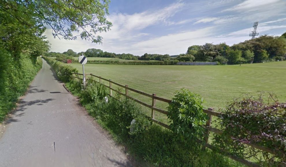
The loss of open space on the northern edge of Undy has concerned local resident Nicola Smith.
“All the fields north of Undy and south of the M4 are being built on,” she told the Local Democracy Reporting Service. “I used to walk the dog in the fields but now I will have to put the dog in the car and drive to Caldicot Castle and that doesn’t seem very environmentally friendly.”
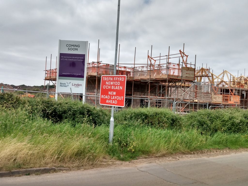
She lives along Vinegar Hill, a steep, winding, lane where there has been piecemeal residential development, with new housing now going up on fields between it and the M4.
Those developments – 72 homes on the western side of the hill, with a further 70 homes on the opposite field approved in April this year – are the result of the land having been included in the council’s current planning blueprint which was adopted in 2014.

But Mrs Smith said despite being supplied with pages of documentation from the council, after using the Freedom of Information Act, she cannot see how the fields lost the protected status they previously enjoyed.
Documents show in 2008 the fields were part of the ‘green wedge’ intended to prevent towns and villages from merging into one and other and protect the countryside. Developers Bovis Homes had put the site forward for inclusion in the plan at that time but that was resisted by the council. The land was also recognised as an amenity open space.
A 2012 council document said the land was “not suitable for a residential allocation” and that Vinegar Hill was “unsuited to accommodate further traffic” though it said a masterplan, including access would be needed, if it and other nearby sites were to be developed.
In December that year Monmouthshire council submitted its Local Development Plan to the Welsh Government which didn’t include the Vinegar Hill fields.
A year later, in October 2013, after the council had been told by an independent inspector that it needed to identify more housing sites, Vinegar Hill was put up for development in an additional sites paper. The planning blueprint was then approved in 2014.
The planning inspector noted the southern margin of the site had Area of Amenity Importance status, that was “at least partially, to provide a buffer” for a potential Magor/Undy bypass, but developing it could mean an alternative “traffic-calmed course through” the site and new housing, further to the east at Rockfield Farm, could be followed instead.
Mrs Smith has questioned how the council had removed protections.
“A paper drafted in October 2012 proposed to remove the green wedge status and this wasn’t published and it doesn’t seem to have been proposed as part of the local development plan process as the final version was submitted only two months later to the Welsh Government,” she said.
“At some time after 2012 the green wedge was removed and Monmouthshire council aren’t able to confirm the date it was removed or how the decision was arrived at.”
A spokesman for Monmouthshire council said the Vinegar Hill site had been “fully considered” in the process that led to the adoption of the Local Development Plan as its planning policy, which included the inspector’s examination.
“The green wedge status of the site was removed upon adoption of the LDP on February 27, 2014,” said the spokesman who added issues such as highways were considered as part of the planning application which followed.
When further concerns were raised over protections against development at the scrutiny meeting, planning officers said they were routinely reviewed as part of the development plan process.
Cllr Taylor has warned of the lasting impact of decisions made during the on-going process of drawing up the replacement local development plan, which will still be subject to a further public consultation next spring before it is put forward to the Welsh Government in September.
She told the scrutiny committee: “It’s really important to understand once that land is allocated when any application comes in for that land use it is highly unusual for it not to be approved.”