

THE VALE of Glamorgan council has detailed the five sites it is planning to earmark for housing in its next blueprint for the future.
The local authority is at the early stages of developing its replacement local development plan, which lays out a framework for the future development of the area.
An estimated 7,890 new homes are expected to be needed under the Vale’s “medium-growth” estimate during the period to 2036 and council says that, with the 10% flexibility required in national planning policy, it needs to allocate enough space for 8,679 dwellings.
A draft strategy for the replacement local development plan was presented to the council’s ruling body last week which will now go out for consulation. The strategy details five sites that have been identified to provide the space needed for the housing.
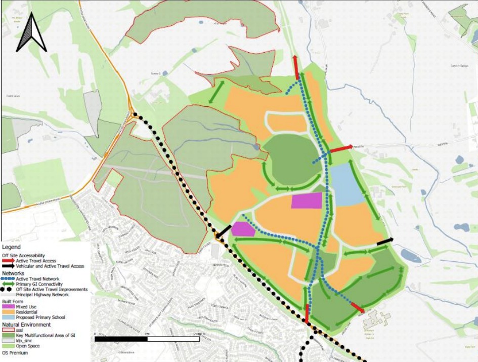
Land in north east Barry
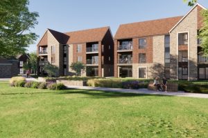
Land in north east Barry has been allocated to deliver 900 homes as part of the council’s preferred strategy.

The site could eventually accommodate 1,500 homes, but 900 of these are proposed to be delivered during the plan period (2021-2036).
Any future developer will be required to provide a minimum of 30% affordable housing on the site, schools, green spaces and a village centre with a mix of services.
They will also be require to make improvements to infrastructure, including the upgrading of highways, pedestrian and cycle access from Gilbert Lane and Argae Lane.
The proposed site is next to the A4231 and St Richard Gwyn Catholic High School is to the south of it.
About 1km away from the site is Cadoxton Railway Station, which is the closest rail link, and the closest GP surgeries to the proposed site are Cadoxton Clinic and Vale Family Practice.

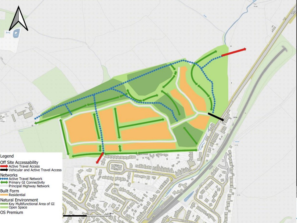
Land to the north of Dinas Powys, off Cardiff Road
Key site 2 in the council’s preferred strategy could deliver 250 homes over the course of the plan period.
The future developer of the site will be required to deliver a minimum of 40% affordable housing, enhancement of green spaces and improvements to infrastructure, including the upgrading of highways, pedestrian and cycle access on to Cardiff Road.
There will also be requirement to provide on and off-site measures for accessible pedestrian and cycle linkages to local services, facilities and public transport, including Eastbrook Station.
Eastbrook Station is just over 200m away from the proposed site and the nearest primary schools are Dinas Powys Primary School and Ysgol Gymraeg Pen-y-Garth.

St Cyres School in Penarth is the closest secondary school to the proposed site.
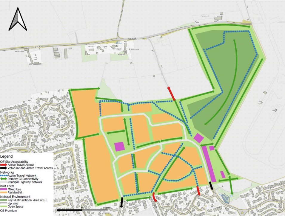
Land at Readers Way, Rhoose
Land at Readers Way in Rhoose is allocated for a residential led development which could consist of 450 homes by 2036.
A minimum of 35% of the homes on site will need to be affordable housing and again, there will need to be improvements to highways, pedestrian and cycle access to serve the site.
The future developer will also need to provide enhancements to leisure, sport and recreation spaces.
Land at Readers Way, which is key site three in the preferred strategy, is currently within a 20 minute walk from the nearest railway station, Rhoose Cardiff International Airport.
The site is also less than a kilometre from the nearest pharmacy, GP surgery and primary school, which is Rhws Primary School.
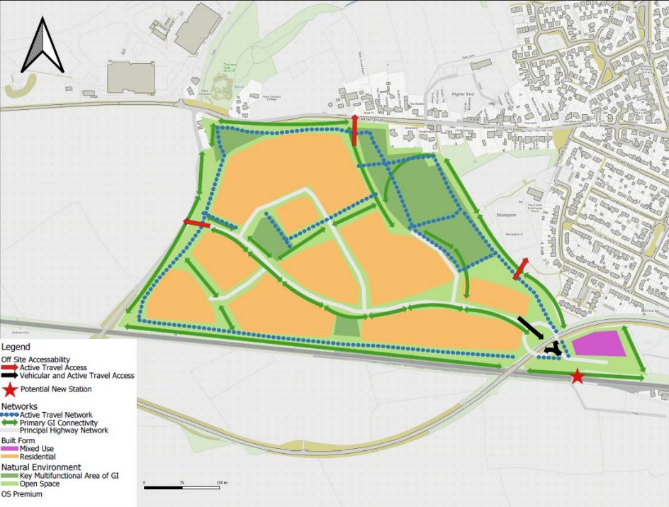
Land at Church Farm, St Athan
Land at Church Farm has already been allocated for housing as part of the current adopted LDP, which runs until 2026.
However, a proposal has been put forward to extend the allocation to incorporate an adjoining field to the east of the site.
Collectively, the 24.6ha site is expected to deliver between 250 and 500 new homes.
The site is proposed to be accessed off Gilestone Road. A primary School, St Athan Primary School, a GP practice and pharmacy are nearby.
It is proposed that the key site should provide a minimum of 35% affordable housing, pedestrian and cycle links to local services and enhanced green spaces.
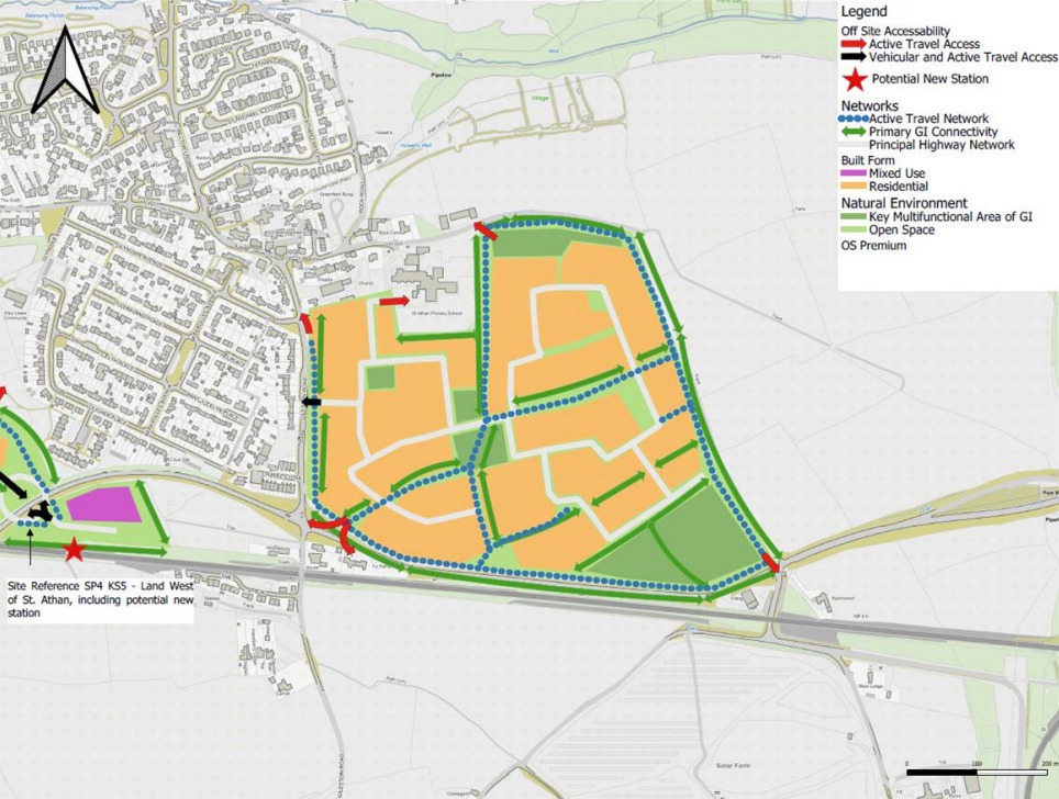
Land to the west of St Athan
It is proposed that land to the west of St Athan, between Lantwit Road and the railway line, should be used to deliver 600 homes.
A minimum of 35% of all new homes on the site will be required to be affordable.
There will be a requirement for on and off-site measures to provide links to local services, facilities and public transport.
There hasn’t been a railway station in St Athan since 1964, when the Vale of Glamorgan line closed.
However, the re-introduction of a station is currently being considered.
The Vale of Glamorgan line reopened in 2005, but the closest stations for residents in St Athan currently is either Rhoose Cardiff International Airport or Llantwit Major.
What happens next?
The public consultation on the council’s preferred strategy for its RLDP will run for eight weeks from December to January.
Following this, the council will commence work on the deposit RLDP with a view to undertaking another six week consultation on this between February and March 2025.
If all goes according to plan, the council expects to submit its RLDP to the Welsh Government in November 2025 and the adoption of the plan could take place between August and September 2026.