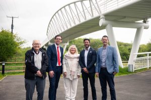

SWANSEA’S Kilvey Hill offers locals and visitors alike free, unfettered access to green open spaces, and has become the battleground for a heated debate that pits Swansea Council against the Open Spaces Society.
This contention centres on the council’s plans to develop part of the hill in partnership with Skyline, a proposition that has stirred controversy over its implications for legal precedent, public access, and the preservation of natural beauty.
Swansea Council staunchly defends its position, refuting the Open Spaces Society’s assertions that any potential land disposal for the project would contravene legal boundaries.
A spokesperson for the council clarified, “The council must act in accordance with its own policy, which permits the disposal of land only if it is surplus to requirements. Kilvey Hill, providing informal recreational access, is essential for our community.”
They further argue that the Skyline development, poised to encompass 9% of Kilvey Hill, has been misrepresented by critics.
Highlighting a significant oversight, the spokesperson noted, “It is disingenuous to discuss a percentage of the entire hill when roughly half is inaccessible to the public, being either agricultural land or otherwise enclosed. The development impacts approximately 37% of the publicly accessible land, a substantial portion.”
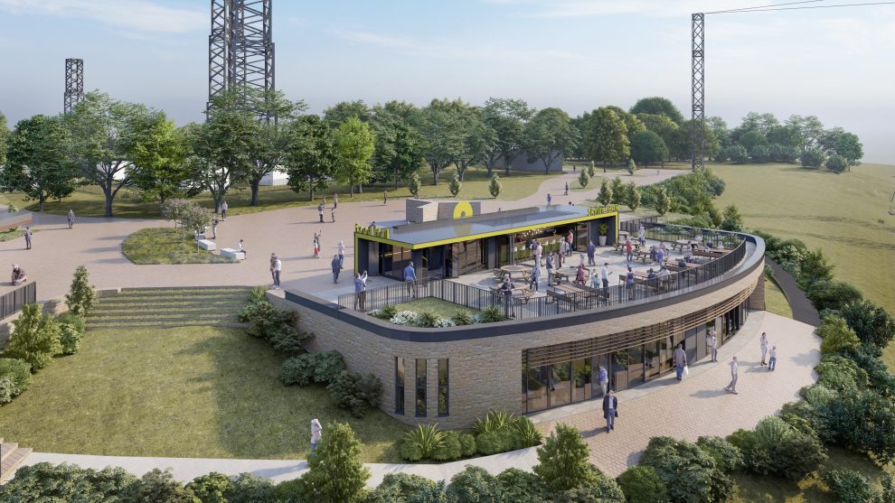
In stark contrast, the Open Spaces Society offers a grim forecast for Kilvey Hill’s future should the development proceed. They contend that the introduction of large buildings, infrastructure for 22 gondolas, 1.6 kilometers of high-speed luge runs, and a 50-metre, multi-towered sky swing will irreversibly mar the hill’s natural landscape.
“The society is particularly concerned that some development will encroach on land mapped as access land under the Countryside and Rights of Way Act 2000, leading to inevitable restrictions for health and safety and operational reasons.”
The argument extends to the historical and current usage of pathways across Kilvey Hill. Despite the council’s assurance of having added five miles of public footpaths to the definitive map, a gesture aimed at recognising routes established since 1983, the Open Spaces Society accuses the council of neglecting its responsibilities.
They argue, “No definitive map can be up-to-date, as routes are constantly being discovered. Swansea’s map, notably late in its conception, fails to capture the full extent of pathways used by the public.”
The society further criticises the council’s lack of initiative in encouraging public submissions to officially register unrecorded routes, and for not adding bridleways and byways that reflect the area’s long-standing equestrian tradition.
This ongoing saga not only highlights the tension between development initiatives and conservation efforts but also touches upon broader issues of public land usage, legal obligations towards footpaths and bridleways, and the community’s right to enjoy natural landscapes.
As Swansea Council and the Open Spaces Society continue their standoff, the future of Kilvey Hill remains uncertain, embodying a pivotal moment for the balance between progress and preservation in the heart of Wales.
A Swansea Council spokesperson said: “We completely refute the Open Spaces Society’s claim that any potential disposal by the council of this land would be unlawful.
“If the Skyline plans go ahead, then the company says the development would cover 9% of Kilvey Hill.
“As part of the development Skyline intend to allow free, unhindered access to Kilvey Hill to continue.
“We have not received any applications to record unregistered routes on Kilvey Hill from the public, and the council is under no obligation to record them as formal public footpaths or bridleways.
“It is nonsense to claim we have don’t have an updated map. We produced a new edition of the definitive map last year, which shows the many footpaths and bridleways that have been added by the council since 1983. This includes five miles of public footpaths on Kilvey Hill that were recorded in 2012 despite opposition from the Open Spaces Society.”
Kate Ashbrook, Open Spaces Society said in response: The council must act in line with its own policy. It can only dispose of land if it is surplus, ie not required to deliver its operational functions. Kilvey Hill provides free informal recreational access to green open space for the public and therefore it is required.
“It is disingenuous to take a percentage of the whole hill when about half of it is not available to the public, it is agricultural land or otherwise enclosed. The publicly accessible land which is affected by the development is in the region of 37 per cent, more than one third.”
Ashbrook added: “Skyline’s proposed development will not coexist with the free, unhindered access which people have enjoyed up to now. It is on a vast scale and will totally change this much-loved, natural, open landscape.
“There will be large buildings and other structures, such as the infrastructure for 22 gondolas, 1.6 kilometres of high-speed luge runs and a 50-metre, multi-towered sky swing. At least some of the development will be on land mapped as access land under the Countryside and Rights of Way Act 2000, with areas fenced off for health-and-safety and operational reasons.”
She went on to explain that the council has received much evidence of use for routes on the hill, not least at the public inquiry into the creation orders for footpaths in 2012.
Ashbrook said: “The council has a duty, if it discovers evidence of public highways, to make an order to add them to the map. It has not done so. It has also not actively encouraged the public to come forward with applications. It has certainly been pressed to add the routes to the map even if no formal applications have been made.
She said in conclusion: “No definitive map is up to date because routes are constantly being discovered; even when it has just been reviewed it is not up to date. It is not surprising that Swansea’s map is not comprehensive because it had a late start. The society opposed the proposed creation orders for footpaths on Kilvey Hill because we believed that they should be recorded as bridleways and restricted byways, there being evidence of their use as such.
“To date no bridleways or byways have been added to the definitive map for Kilvey Hill, despite a long-standing tradition of keeping horses on and around the hill. We considered it was an inappropriate use of council funds to make creation orders—these imply the routes did not already exist and potentially require compensation to landowners, instead of definitive map modification orders which are to record highways which already exist.”