

DR MARTIN Bates, a geo-archaeologist at the University of Wales Trinity Saint David has been working with a research team led by the University of Bradford as they explore “Europe’s Lost Frontiers”.
This month, the team, which also includes researchers from the Institute of Technology Sligo, University College Cork and the Irish Marine Institute, will carry out an expedition to explore the extensive submerged landscapes that exist between Ireland and Great Britain.
Following the last Ice Age, large areas of habitable land were inundated following climate change and sea level rise across the world. Globally, the sea level rose c. 120 metres and an area more than twice that of the modern United States of America was lost to the sea. Beneath the waves of the Irish Sea is a prehistoric ‘palaeo-landscape’ of plains, hills, marshlands and river valleys in which evidence of human activity is expected to be preserved.
This landscape is similar to Doggerland, an area of the southern North Sea and currently the best-known example of a palaeo-landscape in Europe. Doggerland has been extensively researched by Professor Vince Gaffney, Principal Investigator of the “Europe’s Lost Frontiers” Project.
Research by the project team has also provided accurate maps for the submerged lands that lie between Ireland and Britain” said Professor Gaffney, “and these are suspected to hold crucial information regarding the first settlers of Ireland and adjacent lands along the Atlantic corridor”.

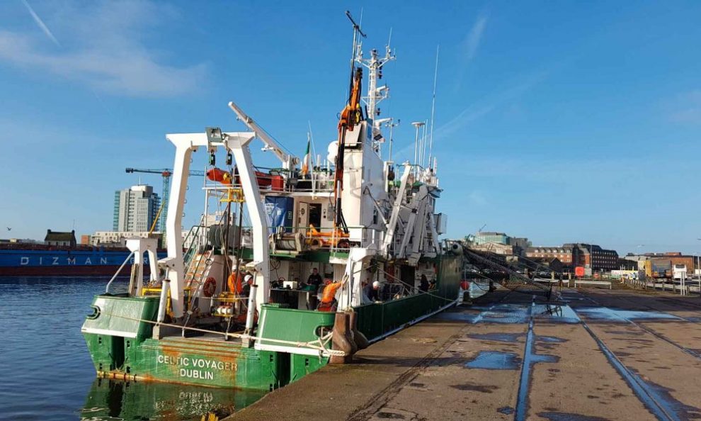
To provide this evidence, sediment from c. 60 cores, taken from 20 sites by the Irish Research Vessel RV Celtic Voyager in Liverpool and Cardigan Bays from February 21 to February 25, will be studied by an international research team.
“This is a very exciting opportunity as the cores we are collecting are the first drilled in the Cardigan Bay sea bed since perhaps the 1970’s,” says Dr Martin Bates.
“They are going to provide us with material that will really help us to understand how Cardigan Bay changed as the sea flooded across the landscape during the time that people were coming back to Wales after the last glaciation.”
Dr James Bonsall, from the Centre for Environmental Research Innovation and Sustainability (CERIS) in the Department of Environmental Science at IT Sligo, is the Chief Scientist for this phase of the research, and his CERIS colleague, Environmental Scientist Eithne Davis will be on board the RV Celtic Voyager, directing operations.
“It is very exciting, as we’re using cutting-edge technology to retrieve the first evidence for life within landscapes that were inundated by rising sea levels thousands of years ago,” says Dr Bosnall.

“This is the first time that this range of techniques has been employed on submerged landscapes under the Irish Sea. Today we perceive the Irish Sea as a large body of water, a sea that separates us from Britain and mainland Europe, a sea that gives us an identity as a proud island nation. But 18,000 years ago, Ireland, Britain and Europe were part of a single landmass that gradually flooded over thousands of years, forming the islands that we know today.
“We’re going to find out where, when, why and how people lived on a landscape that today is located beneath the waves”.
Key outcomes of the research will be to reconstruct and simulate the palaeo-environments of the Irish Sea, using ancient DNA, analysed in the laboratories at the University of Warwick, and palaeo-environmental data extracted from the sediment cores.
The studies will be of immense value in understanding ‘first’ or ‘early’ contact and settlement around the coasts of Ireland and Britain, but also the lifestyles of those people who lived within the inundated, prehistoric landscapes that lie between our islands and which have never been adequately explored by archaeologists.


Add Comment