
PLANS for up to 10 new homes on wasteland on the edge of Blaenavon have been submitted to Torfaen Borough Council.
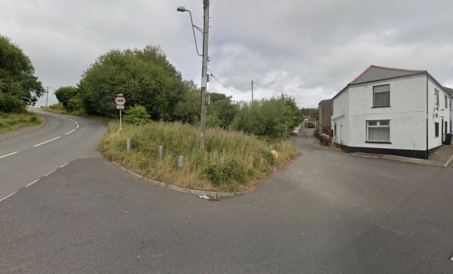
Permission is being sought to allow the development of land on alongside Rifle Street and between it and the B4246 Abergavenny Road.
The site isn’t included in Blaenavon’s “urban boundary” as marked in the borough council’s local development plan but a statement describes it as only just outside the development area.
The application also highlights that permission was previously granted to develop the land, in 2011, but that expired in 2016 as a legal agreement required wasn’t progressed.
The statement, on behalf of applicants Mr and Mrs G and S Sidhu, of Treherbert, says the application “by the new landowners seeks to resurrect the principle of development of the site.”

It states though the site is outside the development boundary “it is however, an infill site between the included areas of Bunker Hill and Rifle Green, and given that the previous application was recommended for approval, it seems reasonable to presume that development of the site would be in the public interest.”
It is also described as within walking distance of schools, local shops, GP surgeries, places of worship and pubs and restaurants, with regular bus services, nearby at Elgam Avenue, to the centre of Blaenavon and Cwmbran meaning it meets Welsh planning policy on location and sustainability.
The current application is for outline permission only meaning all other matters including the total number of homes, their design and access would be covered by a further application.
A suggested layout, showing how 10 homes could fit into the space, has been included in the application which is also for the homes to have gardens and up to two dedicated parking spaces for each house.
Though access has been reserved to a later application it is anticipated a 5.5 metre wide road could be created from Rifle Street, close to its junction with the B4246.

The site is currently classed as “poor quality” and “very poor quality” agricultural land with a small area near to the proposed access point considered “urban” and “non-agricultural” land. It is stated a “wild woodland boundary” to the north and west providing biodiversity enhancements could form part of the landscaping with “a large number of existing trees retained”.